Owning property near a river, creek, or seasonal drainage can offer beautiful views and desirable building sites, but it also comes with additional regulations. Understanding Jackson County floodplain development requirements before purchasing land or beginning construction can save significant time, money, and frustration. Floodplain regulations are designed to reduce flood risks, protect lives and property, […]
Floodplains
Understanding Floodplains and Wetlands: Why Expert Guidance Matters
When purchasing or developing property in Southern Oregon, it’s easy to get excited about the possibilities—expansive views, fertile land, or prime development opportunities. But beneath the surface of every transaction lies a critical set of land use rules that can make or break your plans: local ordinances governing floodplains and wetlands, outlined in Chapter 7 […]
Property in a Floodplain? What You Need to Know.
Southern Oregon’s scenic landscapes, with its lush forests, winding rivers, and breathtaking valleys, often draw prospective homeowners seeking serenity and natural beauty. However, nestled within this picturesque region are designated floodplains, areas prone to flooding during periods of heavy rainfall or snowmelt. For those considering purchasing property in a floodplain, it’s essential to be well-informed […]
Understanding Floodplain Determination in Southern Oregon

Floodplain determination is a crucial aspect of land use planning and development, as it helps communities understand their flood risk and make informed decisions about reducing or managing that risk. This article provides an overview of how floodplain determination works in Jackson County, Oregon. How are Floodplains Determined? Floodplains are determined using Flood Insurance Rate […]
What Happens If My Lot is in a Flood Plain?
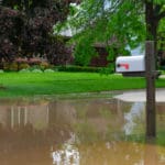
In Jackson County, Oregon, the Planning Department relies on FEMA’s Flood Insurance Rate Map (FIRM) panels to determine which properties reside within flood plains. This is a very typical process for most local planning departments. Flood plains are simply areas that are at risk for natural flooding from a nearby waterway. FEMA develops and updates […]