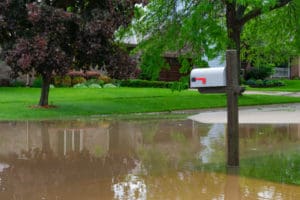
 In Jackson County, Oregon, the Planning Department relies on FEMA’s Flood Insurance Rate Map (FIRM) panels to determine which properties reside within flood plains. This is a very typical process for most local planning departments. Flood plains are simply areas that are at risk for natural flooding from a nearby waterway. FEMA develops and updates its FIRM Panels regularly by analyzing the flooding history in the area.
According to FEMA’s website, “Flood hazard areas identified on the Flood Insurance Rate Map are identified as a Special Flood Hazard Area (SFHA). SFHA is defined as the area that will be inundated by the flood event having a 1-percent chance of being equaled or exceeded in any given year. The 1-percent annual chance flood is also referred to as the base flood or 100-year flood.”
What are the requirements for flood insurance?
All property owners within designated flood plains are eligible to purchase flood insurance through the National Flood Insurance Program. In most cases, lenders will require mortgage holders to buy flood insurance for property in these zones. Planning departments may require developers or contractors to use certain specifications within these areas as well. All of these requirements can be costly.
What many home and landowners may not realize is that standard homeowners and business insurance policies typically do not cover flood damage or will only cover specific structural damage but not personal property. FEMA’s flood insurance policies cover this gap and can be purchased through most insurance companies.
What is a Letter of Map Revision (LOMR)?
A LOMR is an application made to FEMA requesting a change to one or more flood zones, base flood elevations, or wave crest elevations on FIRM Panels. These are typically completed when there is new information to be considered for flood plain analysis, particularly in locations still relying on antiquated maps. An approved LOMR can change the specific type of flood zone to designate the area as having less risk.
Contractors may also apply for a LOMA or LOMA-F. This is a similar process but requests that a specific structure, not the property itself, be removed from having an SFHA designation on the FIRM Panels. In these cases, the contractor has altered the property in some manner, such as using additional fill to elevate the structure to reduce the risk of flooding significantly. Approved LOMAs often eliminate the requirement for flood insurance.
How do you know if your property is in a flood plain?
It’s easy to determine whether your existing property or one you are considering for purchase is within a designated flood zone. You can begin with a simple map search using FEMA’s online Floop Map Service Center.
What should I do next?
The experts at Richard Stevens & Associates can help you understand the flood zone maps applicable to your property and the impact on your development plans. In fact, we can complete a full feasibility study of your property to determine the best land use and planning options for your parcel of land. Simply give us a call at 541-773-2646 to learn more about how we can make your land or property development process easier.

Leave a Reply